North East Link – Australia’s Mega Transport Project
Melbourne Central city and its outer suburbs are bursting at the seams, and the traffic is becoming unbearable. Crowded footpaths and jam-packed trams and buses are now part of its daily life. If don’t addressed, the city’s growth will overwhelm its current infrastructure and make traffic problems even more unbearable. Recently, city planners came up with a smart and innovative solution to manage this increase and keep Melbourne a great place to live.
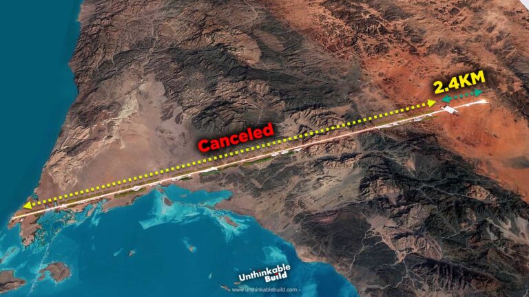
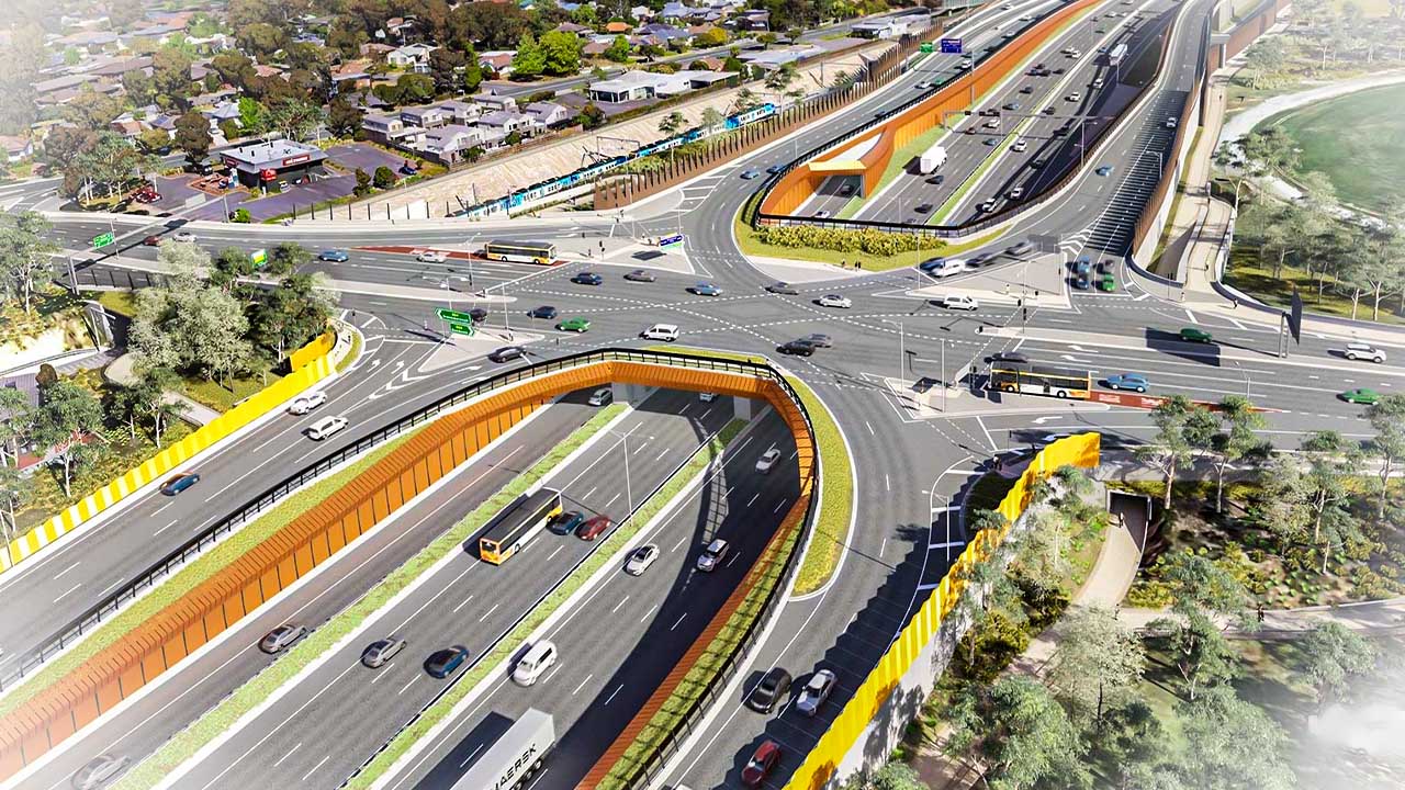
The North East Link is the largest infrastructure project of its kind in Victoria, featuring the construction of a 6.5-kilometer tunnel from Watsonia to Bulleen to address the missing link in the city’s freeway network. This monumental $26 billion project aims to transform Melbourne’s transportation landscape by significantly improving traffic flow, reducing congestion on local roads, and enhancing connectivity across the city. In addition to the tunnels, the project includes upgrades to existing roads, new interchanges, and enhanced public transport options, all designed to create a more efficient and resilient transport network for Melbourne’s growing population.
Urban planning plays a vital role in reducing the need for long commutes. Designing neighborhoods with a mix of residential, commercial, and recreational areas can minimize the distances people need to travel for daily activities. This integrated approach can lead to a decrease in overall traffic volume.
Victoria’s capital, Melbourne, has a road network that is essential to its transportation system. The city features an extensive array of freeways and arterial roads. Freeways connect Melbourne to other major cities and regional centers, while arterial roads serve as primary routes within the city, linking suburbs and facilitating traffic flow.
Despite being Australia’s second-largest city, Melbourne’s road network has struggled to keep pace with its rapid population growth. Major arterial roads often cannot accommodate the increasing number of vehicles, resulting in frustrating delays.
Additionally, the city’s booming population and the increasing number of people choosing to drive rather than use public transport significantly contribute to traffic congestion.
Also Read: Sydney Is Getting New $3.42 Billion Mega Airport
Going back in history, the 1969 Transportation Plan holds a significant position in Melbourne’s road network, marking a pivotal policy that shaped its transport infrastructure. After the World War II, Melbourne experienced rapid population growth, surpassing 2.1 million by 1966. This post-war surge, coupled with the rising trend of car ownership and suburban living, played a crucial role in shaping urban planning decisions. Consequently, the city saw the emergence of car-centric suburbs characterized by detached homes and garages as the prevailing development pattern.
Chadstone was Melbourne’s first modern shopping mall opened in 1960, adopting the US model of car-based planning. Similarly, the 1954 Metropolitan Planning Scheme promoted low-density suburban development and a comprehensive freeway system, further reinforcing the car-centric approach. Supervised by US consultants, the 1969 plan anticipated even greater car usage and proposed an extensive road network, including 494 kilometers of freeways. However, it overlooked the impact on urban form and community spaces.
In 1972, shifts in leadership prompted the cancellation of numerous freeway routes across Melbourne. While the Metropolitan Ring Road and Eastern Freeway persisted, essential north-south connections were deferred until the late 1970s. Despite earlier assurances, planning for these connections quietly persisted. Several fresh proposals surfaced, ranging from local road enhancements to new arterial roads and even freeway constructions. However, these plans never came to fruition, leaving Melbourne’s freeway network incomplete.
Fast forward to 2007, when a significant report revived discussions about a Northeast Link in the city. By 2016, Melbourne was grappling with severe congestion, reaching critical levels, prompting immediate action. In 2017, the government finally moved to tackle the issue, allocating funds to initiate planning for the Northeast Link.
The construction of new highways in Melbourne, such as the North East Link, serves several important purposes. One of the primary benefits is reducing congestion. As Melbourne’s population continues to grow, traffic congestion has become a significant issue. New highways help alleviate this by providing additional lanes and better road infrastructure. This expansion is crucial for accommodating the increasing number of vehicles on the road.
Improved travel times are another major advantage. The North East Link will connect Watsonia to Bulleen, filling a crucial missing link in the freeway network. This project is expected to reduce travel times by up to 35 minutes, making commutes faster and more efficient.
The project also addresses the issue of truck traffic. Highways like the North East Link aim to remove around 15,000 trucks from local roads daily, improving safety and reducing congestion for communities in Melbourne’s northern and eastern suburbs. This shift will not only make local roads safer but also enhance the overall flow of traffic.
As part of the North East Link project, construction is progressing on the state’s longest twin road tunnels that will pass under the Yarra River. These tunnels have been lengthened to span 6.5 kilometers in total, with an extra 1.9 kilometers added to meet the project’s expanded requirements. The tunnels are being excavated at varying depths, including sections descending up to 60 meters below the ground, necessary to navigate Melbourne’s diverse terrain and existing infrastructure. Initially designed with three lanes for cars, the tunnels will expand to four lanes from Bulleen to the Eastern Freeway as part of the project’s comprehensive upgrade.
Scheduled for completion by late 2028, these tunnels, each 16 meters wide, are expected to significantly enhance travel routes, boost transportation efficiency, and ultimately cut down commute times for both residents and commuters. Separated by approximately 7 meters of earth, the tunnels will feature emergency passages placed at intervals of around 110 meters for added safety. These passages will enable motorists in one tunnel to safely switch to the other in case of emergencies, ensuring the overall safety and reliability of the infrastructure.
Also Read: Dubai Mangroves: A Project to Save 72 km of Coastline
The Northeast Link project extends beyond tunnels. It encompasses the creation of a dedicated bus-way along the Eastern Freeway, specifically serving the Doncaster area, along with new park-and-ride facilities. This bus-way aims to enhance public transport choices and alleviate traffic congestion on nearby roads. The project represents a significant endeavor, with current costs estimated at $26.1 billion, aimed at revolutionizing Melbourne’s transportation infrastructure. Once completed, it promises to offer a smoother travel experience for approximately 100,000 vehicles daily.
Early works on North East Link project commenced in 2020, marking the beginning of preparations for this ambitious project. Construction on the North East Link tunnels had commenced by late 2022, a critical component of the initiative aimed at enhancing Melbourne’s freeway network.
In late 2023, delivery teams were appointed to oversee the overhaul of the first segment of the Eastern Freeway and the completion of upgrades to the M80 Ring Road, pivotal steps in preparing the infrastructure for the new link.
In addition to these transportation benefits, there is a significant economic impact of North East Link project. Infrastructure projects like the construction of new highways generate employment opportunities and stimulate economic growth. The development process creates jobs and boosts local economies, contributing to the overall prosperity of the region.